Brief
At the start of the Ukraine conflict, it was vital for Janes to be able to communicate the information it had on the situation and open-intelligence it acquired on a very frequent basis. Due to resource and time constraints, I was tasked with rapidly creating a video that could be used to help communicate the daily news of Ukraine across multiple channels.
Production
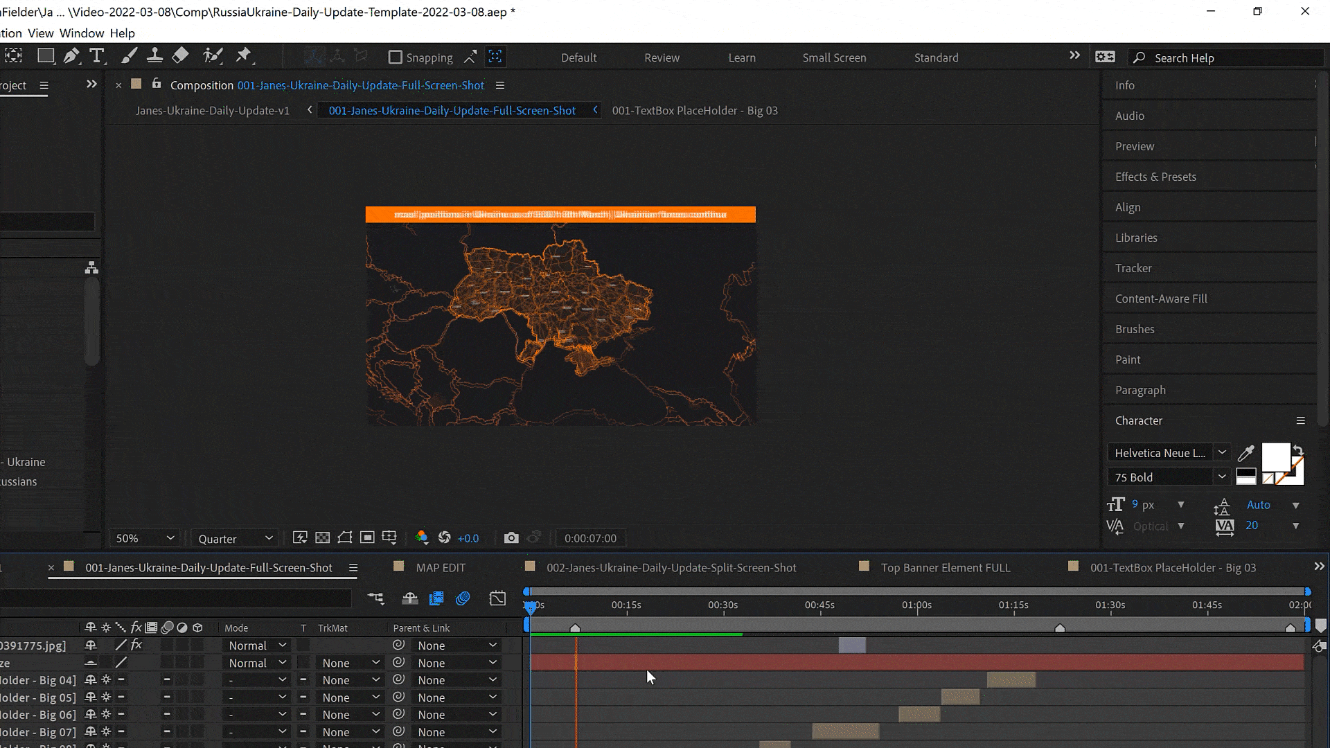
The first video needed to be ready in the space of two days, and then be used ongoing, producing a video each day, and then moving to weekly. As a result, I have to create a working, usable template within 8 hours that would allow us to communicate the events of the day.
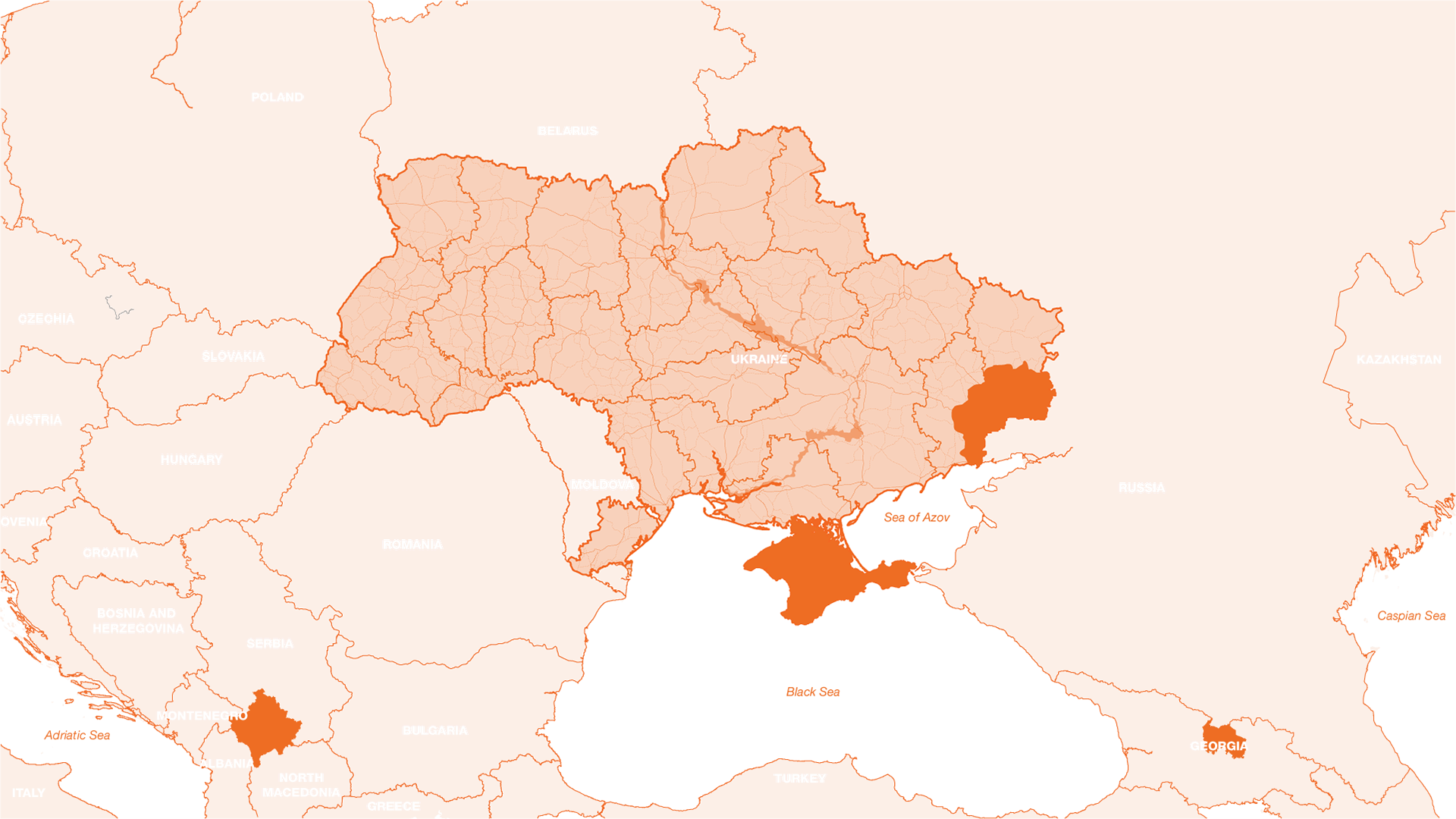
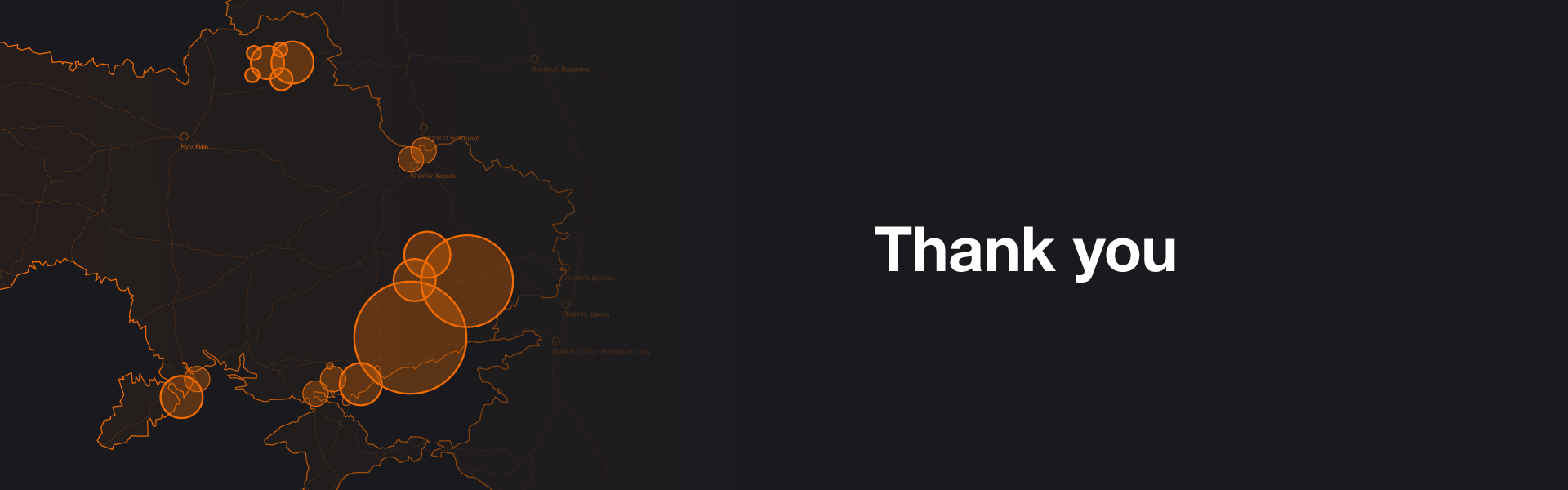
interactive map of Ukraine with complete road network
The first video needed to communicate clearly the different movements of units, positions, defeats, victories and other strategic information. It needed to be able to display text, images, and allow room for an analyst to talk to. The video length would also change depending on the amount of information in any given day, from 1 minute up to 2.5 minutes.
This meant having to create a complete video suite, capable of rapid content entry and modification. It also needed to be very quick to amend, in case, during the approval process, information needed changing. It was vital that the video production time was kept to a minimum, so the information was the most up to date, as strategic information could be outdated in the space of a few hours.
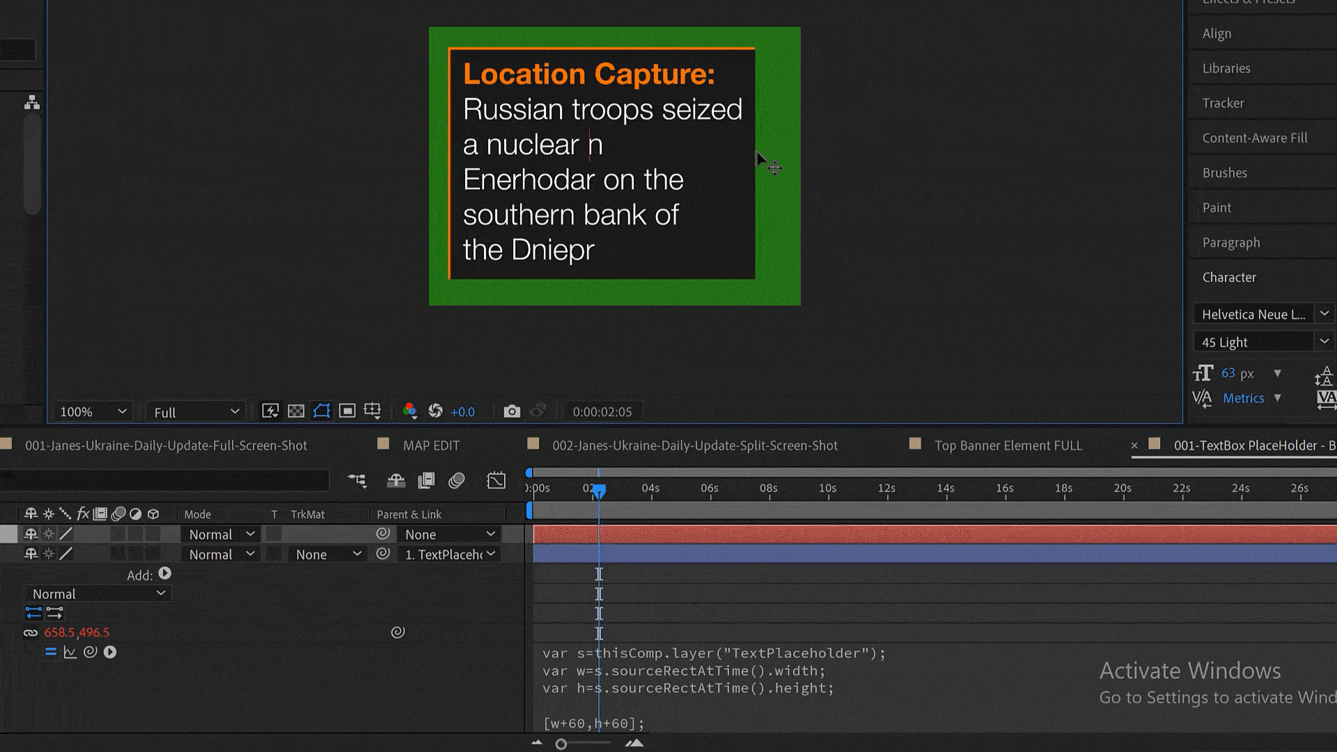
After planning in for all these factors, I was able to produce a video that could be rapidly reviewed and edited by using an assortment of different expressions and tools. I set up a series of text boxes which would change in size based on the text included, meaning an editor would only have to copy and paste information by an analyst.
The next part was to create a fully operational map of Ukraine. By using existing materials, I built a complete map of Ukraine in illustrator. This map is extremely detailed, featuring cities and the complete highway and major road networks in Ukraine, as well as other key strategy elements the analysts recommended. I then imported this into After effects and applied expressions and controls to this map, so when scaled, different elements would appear/disappear for render efficiency, as well and changes in stroke weights, so that the map would always contain different elements depending on scale. This allowed an editor to only adjust the scale of the map in the pre-comp, and the rest of the work would automate.
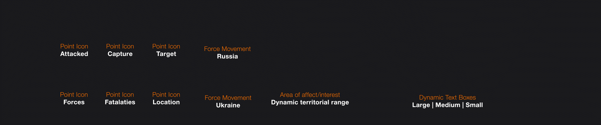
I also created a design system for the map for demonstrating different scenarios and allowing an editor to simply drag and drop elements onto the map. Using this system meant we were able to turn around a video within a 2-hour window or less and push up onto our channels and provide to key clients and news organizations.